Stamp River Steelhead Report
Jan 29 2019
Overview - River Conditions - Weather Outlook - Regulations
Overview
| River Moderate Levels |
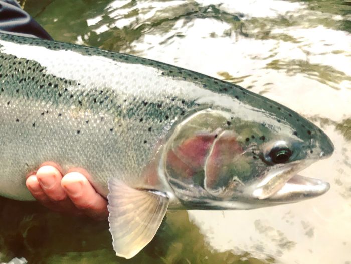
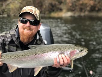
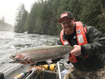
| River is in great shape at about medium winter levels which has provided for some reliable opportunities this past week and looking forward., Most trips have been encountering between 2-5 Steelhead per day with a few bright winter runs in the mix of predominantly fall runs Steelhead. Good time to get out there and get your fish on! |
 |
 |
 |
Winter Steelhead - Guided Day Trips
Fully guided day trips for two persons by jet boat includes all of the equipment. $225 per person based on double occupancy. Trip Details »River Gauges
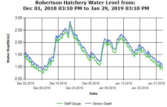
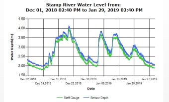
DFO has a series of gauges on the river which we utilize to share information on levels. There is the gauge at Robertson Creek, Stamp Falls and the Sproat River. Stamp Falls gauge is our key indicator that we follow to indicate trends. This gauge is below the confluence of the Ash and Stamp, so high higher volumes than the one at Robertson Creek which is on the very upper Stamp.The graphs below are the 1 month trend. When you click and go to the live data you will see a calendar so you can back date the start date for the graph. The default of the live data set is one week.
The other functioning gauge is the Sproat River. In high water conditions this is very helpful towards indicating the trend but it is a very short river with Sproat lake behind it. The Sproat River gauge which is a few km above where it empties into the Somass River.
Updated river level reports can be generated by links on graphs or at http://www.pacfish.ca/wcviweather/
 |
 |
Weekly Weather Outlook

Winter Regulations: Stamp/Somass/Sproat System
Download Region 1 Vancouver Island Regulations
Licenses and Steelhead : Steelhead fishing: Your basic licence must be validated with a Steelhead
Conservation Surcharge Stamp if you fish for steelhead anywhere in B.C. weather your intention is to release or retain. Get your licence online.
Gear: Single barbless hook must be used in all streams of Region 1, all year.
Locations Referenced:
Upper River - Above Stamp Falls
Middle River - Stamp Falls Pool to Girl Guide Falls
Lower River - Stamp River at Girl Guide Falls downstream to and including Somass and Sproat Rivers.
Bait Use Permitted: Lower River- Stamp River Lower Section starting downstream of signs at Girl Guide Falls located approximately 250 Meters upstream of beaver creek falls. Use also permitted within Somass and Sproat Rivers.
Bait Ban : Middle and Upper River Bait ban all year Stamp River upstream of signs at “Girl Guide Falls” (approximately 250 m upstream of the mouth of Beaver Creek).
The "Girl Guide Falls" are accessed from the Alberni Sportsman's Association on Sportsmen road off of beaver creek.
Quota/Limit: All wild Steelhead in BC must be released. Daily limit of hatchery Steelhead is 2. Possession limit is 4. We encourage limited or non retention of hatchery Winter Steelhead to spread out availability and opportunity. When you have caught and retained your daily quota of hatchery steelhead from any water, you must stop fishing that water for the remainder of that day.
Call anytime for the latest conditions and reports
250-723-8022
murphy@island.net
Professional Contributor to:
Fishtactics ~ Alberta Outdoorsmen Forum ~ Fishing with Rod ~ BC Outdoors Magazine